

Leosabhal [Leosaval]
Good walks are even better shared.
Overview
Welcome to Leosabhal [Leosaval]
Nestled in the stunning Western Isles of Scotland, Leosabhal stands proud at an elevation of 720 meters and offers a rich tapestry of experiences for the avid hiker. Known affectionately as Leosaval by the locals, this mountain is a Marilyn, meaning it's prominent enough to claim its own place in the hearts of Welsh walkers.
Geology
The slopes of Leosabhal are primarily composed of ancient Lewisian gneiss, a rock that often attracts geologists for its intricacies and age. These rocks tell a story of the Earth's early history, making every step a journey through time—just try not to stumble into a geological age!
Routes
The most popular route is the Torran Road Route, a moderate trail that takes approximately three hours for the round trip over a distance of 5 kilometers. The path is well defined—much easier to follow than the plot of your average soap opera!
Summit Features
Reaching the summit rewards you with a substantial cairn and a trig point that boasts a friend's welcome for all your summit selfies. It's a rocky adventure, so come prepared for a bit of climbing.
Terrain
Expect rugged and rocky conditions with patches of grassy moorland—perfect for those who love to feel truly alive in nature! Just remember that nature was never meant to be orderly!
Views
Upon reaching the top, sweeping vistas of the surrounding Hebrides open up before your eyes. On a clear day, you can spot Harris and Lewis, along with the vast expanse of the Atlantic Ocean. Spring and summer are the best seasons to enjoy these spectacular views, as wildflowers paint the landscape and give you an Instagram-worthy shot (filter optional).
Hazards
While Leosabhal welcomes adventurers, the weather can switch like a cat on a hot tin roof. Stay alert for sudden changes, and navigate carefully, especially on slippery post-rain paths. No one wants an unexpected mud bath!
Nearby Summits
If you're keen to bag a few more peaks, check out the nearby Hecla and Mullach an Dùin, both offering stunning experiences without the need for a second mortgage on hiking gear!
Access
The nearest parking is at the end of Torran Road, so get there early to nab a spot. If you’re relying on public transport, local buses run from Stornoway to Tarbert. A taxi may be indispensable for the last leg of your journey.
Facilities
While there's little at the peak, Tarbert has you covered with cafes and shops where you can refuel after your hike. A good cup of tea is just a stone's throw away!
History
The name Leosabhal embodies the rich heritage of the area; it harks back to Norse roots, giving you a slice of history with your hike. The mountain itself has been a beacon for local communities, standing tall at the centre of their cultural landscape.
So lace up your boots, grab your camera, and set off for an adventure on Leosabhal! Just remember, whether you’re climbing mountains or climbing back into bed after a long day, it’s always about the journey—unless there are snack breaks involved!
Explore routes near Leosabhal [Leosaval]
Public walks starting within 80 km of this hill. Nearby does not mean a route reaches the summit; check its map and access before setting out.
Beautiful private beach walk Isle of Harris
View route
Berneray Community Hall to the beautiful beach
View route
Route planning notes
These notes describe possible approaches, not verified navigable routes or permission to cross land. Check current paths, local access rules and conditions before setting out.
Torran Road Route
A well-trodden path starting from Torran Road that leads up through heather-covered moors to the summit.
Make a day of it, together
Find someone to share the walk with, or organise a day out along a route you like.
Photo Gallery
View all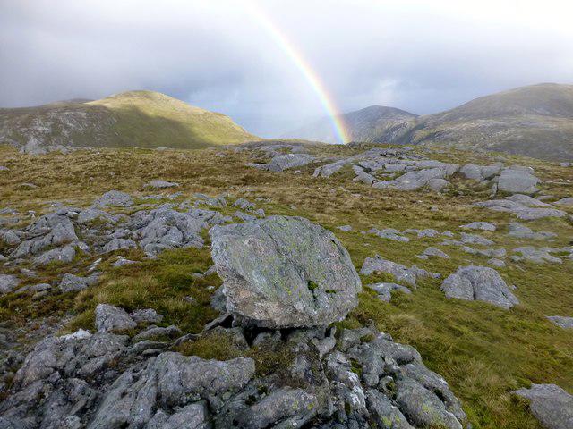 Photo could not load
NB0309 : Leosaval [Leosabhal] Boulder And Rainbow
Rude Health
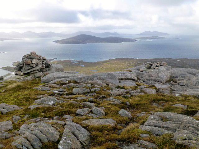 Photo could not load
NB0309 : Leosaval [Leosabhal]
Rude Health
Hill facts and local notes
Classifications
Elevation
412m
1,352 ft
Prominence
143m
Coordinates
57.9791, -7.0116
NB038098
OS Map
13
Explorer: 456
At the Summit
The summit boasts a substantial cairn and offers a rocky viewpoint with a trig point nearby, perfect for photo opportunities.
Terrain & Geology
Leosabhal is primarily composed of Lewisian gneiss, one of the oldest rock types found in the UK, which gives it a rugged character and fascinating geological features.
Views & Scenery
From the summit, you can enjoy stunning views of the nearby Hebrides, including the islands of Harris and Lewis, as well as sweeping vistas of the Atlantic Ocean.
History & Heritage
Name Origin
The name Leosabhal is thought to derive from the Norse 'Leodhusavall', meaning 'hill of the people from Leodhas', highlighting the island's Norse heritage.
Historical Significance
Leosabhal holds cultural significance for the local Gaelic community and has been a landmark for navigators over the centuries.
Getting There & Facilities
Check current local access restrictions, parking rules and transport timetables before travelling. These notes do not confirm public access to the summit.
Parking
Parking is available at the end of Torran Road, near the start of the walking path. Space is limited, so plan to arrive early.
Public Transport
Local buses connect from Stornoway to Tarbert, but the last stretch to Torran Road may require a taxi or a good pair of walking shoes.
Nearby Facilities
There are no facilities at the summit itself, but Tarbert has cafes, shops, and public toilets for pre- or post-hike refreshments.
Safety Information
Known Hazards
- Watch out for sudden changes in weather, which can be quite common in this region. Some sections can be slippery, especially after rain.
General Safety Tips
- Check weather conditions before setting out
- Carry appropriate clothing and equipment
- Let someone know your planned route
- Take a map, compass, and GPS device
- Carry emergency supplies: food, water, first aid kit, torch
Hills
Some common questions about the hills answered
Are there group walks up Leosabhal [Leosaval]?
Many walkers use Walkmates to join or organise walks with others. You can check for group walks around Leosabhal [Leosaval] through the maps
Are there other walkers around Leosabhal [Leosaval]?
Activity varies by location and time, but Walkmates lets you see whether others have shared walks or shown interest in this area. Find other people through the walking friends search walking friends for Leosabhal [Leosaval] search or of course create your own walk for Leosabhal [Leosaval]
Can I organise a walk to Leosabhal [Leosaval]?
Yes. If there aren’t any walks listed already, you can create a walk and make it available for others to join.
If you're signed up to Walkmates, you can create a walk to Leosabhal [Leosaval].
How do I find a walk up this hill?
There are often multiple ways to walk this hill, depending on experience and route preference. Walkmates helps you explore walks and routes that others have shared.
Can I suggest a new route up Leosabhal [Leosaval]?
Yes. You can suggest or create routes to share with others. Walkmates focuses on the social side of walking, so routes are used to help people organise walks and explore areas together, rather than as detailed navigation tools or route libraries.
Other uses really appreciate knowledgeable walkers sharing their routes. Share your favourite route to Leosabhal [Leosaval] here
The is an error or something incorrect about this hill. How do I let you know?
We always strive to keep the information on Walkmates as accurate as possible. If you find an error, please let us know through the contact form and we'll aim to correct it as quickly as possible
Community Discussion
Comments
Location
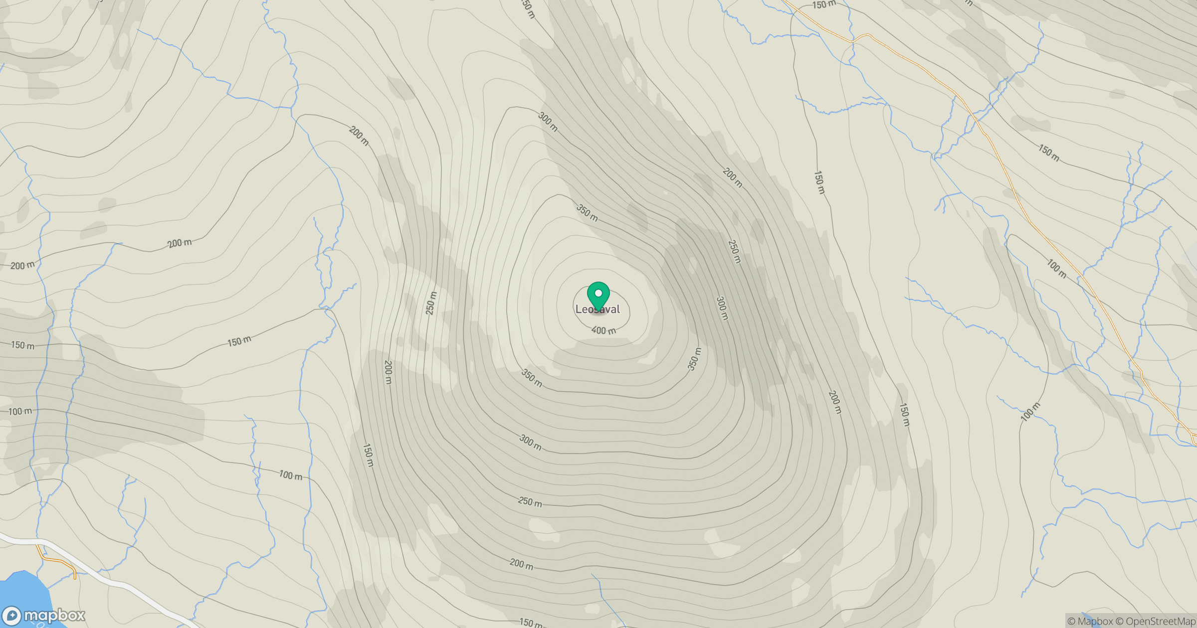
Grid reference: NB038098
View on OpenStreetMapOpens a map in a new tab, centred on the hill.
Hills within 30 km
Straight-line distance, not a walking route or confirmation of access.
An Cliseam [Clisham]
800m
Tiorga Mor [Tirga Mor]
680m
Huiseabhal Mor [Husival Mor]
489m
Sneathabhal Mor
175m
Meall nan Sithean [Meall nan Sidhean]
177m
No comments yet. Be the first.